Sweden’s southernmost point
Discover our picturesque coastal location
The fishing village of Smygehuk is located at Sweden’s southernmost point. It is on the outskirts of Smygehamn in Sweden’s province of Skåne or, as it is called in English, Scania. The southernmost point of Sweden is marked by the coordinates 55.336944° N, 13.359444° E.
A visit to Smygehuk, Sweden’s southernmost point, is an experience no matter what time of year it is. Smygehuk is a flat, sandy point surrounded by stony beaches. It is situated east of Trelleborg, close to Smygehamn. During the summer months there are lots of activities on offer – music, art, culture and shopping. The winter offers clean, crisp air, spectacular sunsets and the magic of transforming Smygehuk into a work of art made from snow and ice.
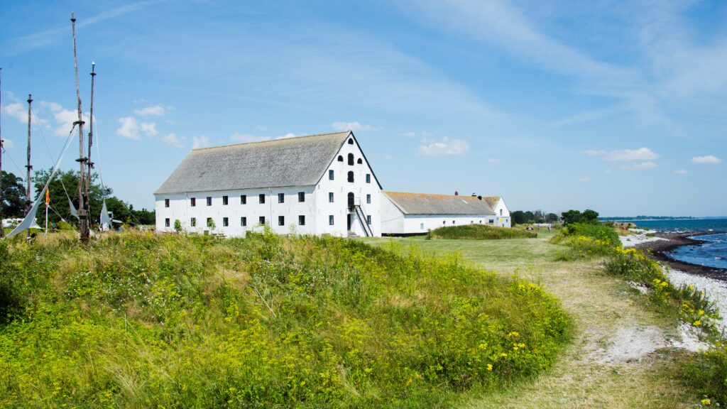
Köpmansmagasinet
The striking old warehouse Köpmansmagasinet was built in the beginning of the 19th century and was one of four trading warehouses in the Smygehamn district. Rumor has it that it was once a smuggler’s nest during the Napoleonic Wars. Today you will find art exhibitions and various events that give a lively and dynamic atmosphere to the area.
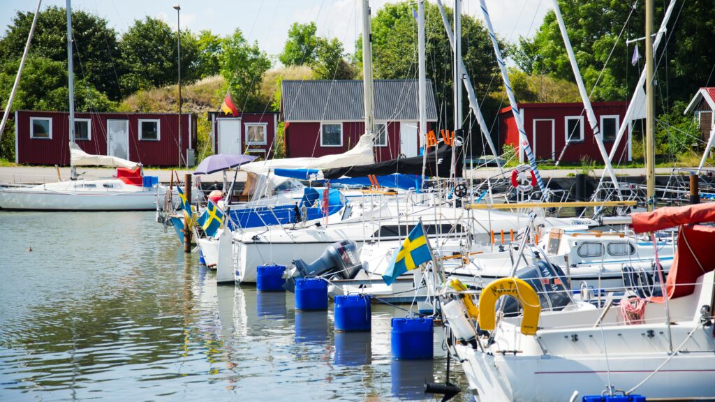
The Harbour
The harbour was built in the 1920s from what was originally a limestone quarry. Now it is one of the three marinas in the area that can be used by visiting boats. The western side of the harbour is lined by small fishing huts and boat sheds which are locally called “hoddor”, where fishermen store their equipment.
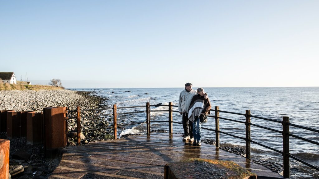
Utkiken
By the East Pier you will find a viewing platform that marks the southernmost place in Sweden featuring a compass rose with the distance to different places in the world. Utkiken with its informative signs is a popular place for photos. The waves can get high around the lookout, so be careful not to get a shower!
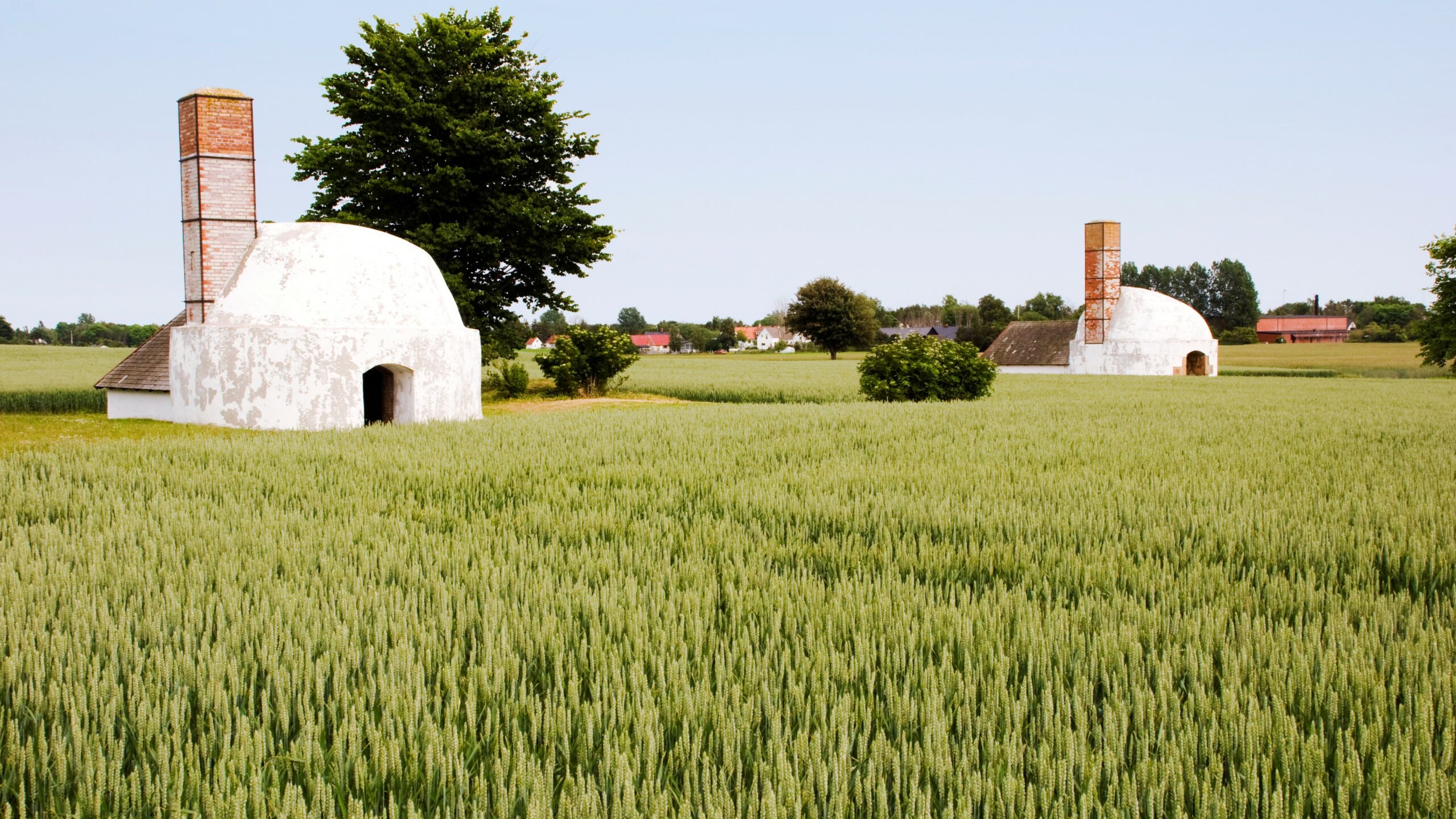
The Limestone Industry
There is still a lot of evidence in the area of the once-booming Limestone Industry. The calcination of the limestone took place in so-called cupola kilns that were used periodically. Nine of the ten kilns periodically used here have been preserved and the oldest dates back to the mid 1800s.
Nature on the point
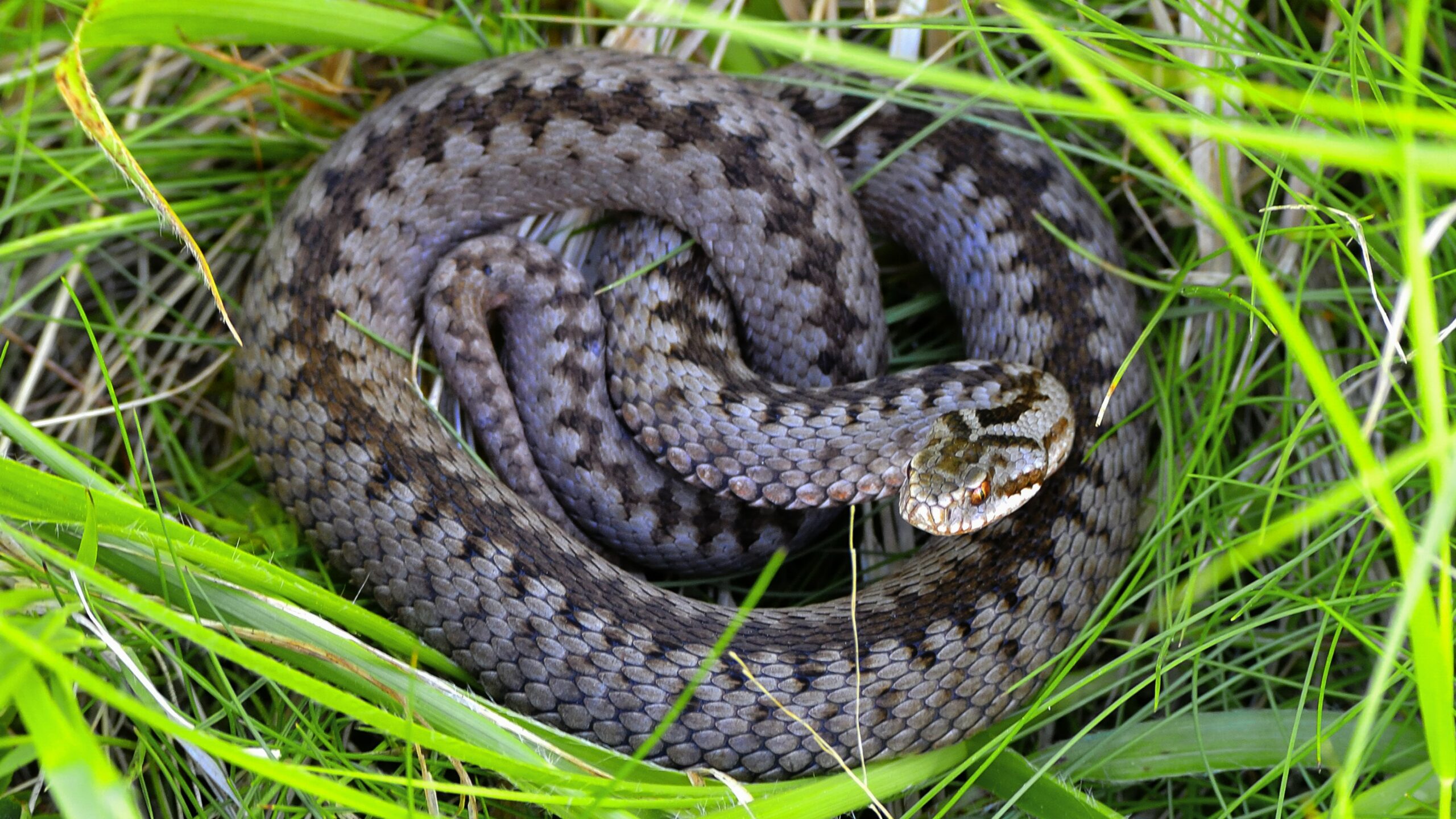
The flora and fauna around the cape are characterized by the limestone-rich soil. The pebbles on the beach have been washed out of the bedrock and you can find fossils of sea urchins that lived 100 million years ago. On the beach meadows between Böste and Smygehuk there is a unique population of free-ranging vipers
Famntaget
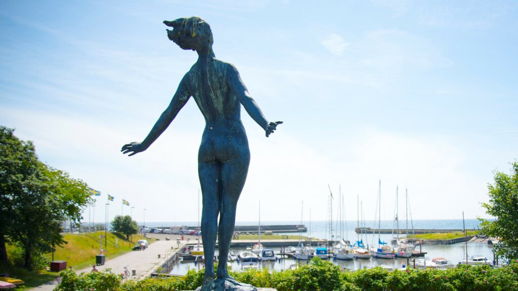
Rumour has it that actor Uma Thurman’s grandmother modelled for Axel Ebbe’s artwork “Famntaget” – known as “The Embrace” in English. The sculpture is in the harbour at Smygehuk where the beautiful figure can be seen stretching out towards the water, hair blowing in the wind, breathing in sea air and soaking up the sun.
Palmbussen
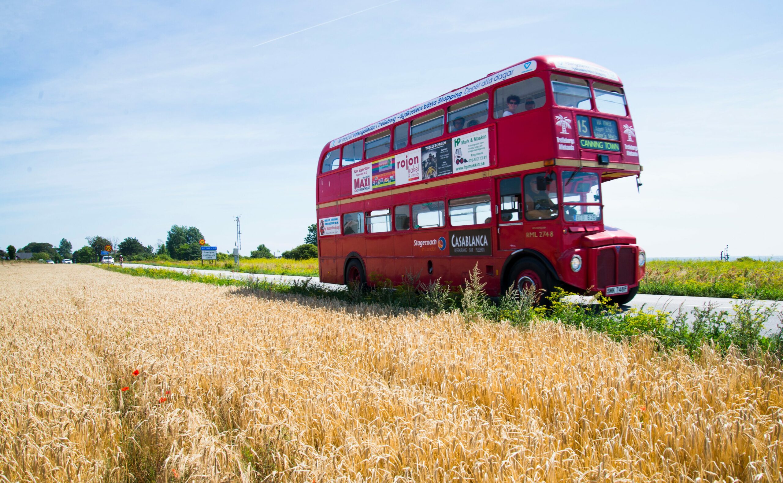
In the summer the red double-decker takes you for free along the beautiful coastline between Trelleborg and Smygehuk!
Smygehuk’s history
Fishing & Limestone Industry
Limestone, fishing and commerce were Smygehamn’s primary sources of income. At the end of the 1800s, limestone mining and processing had reached industrial scale and there were 16 fishermen based in the harbour. By the mid 1900s, the limestone industry was no longer profitable but the number of fishermen had increased to 35, with seven large fishing boats. The railway kept trade alive by transporting limestone, fish and other goods.
Trading & shipping
Previously, there were four large trading warehouses in the area, with the only remaining one, Köpmansmagasinet, being the most impressive in size. With its close proximity to the sea, goods were transported via jetties and barges out to waiting ships. Köpmansmagasinet was likely to have played a part in the many shady deals and smuggling rackets that took place during the Napoleonic Wars.
Beach town, hotels & bars
With the arrival of the railway, Smygehamn became a seaside resort. The fishermen in the village frequented the Östra Torp Strandhotell, which led to protests from the fishermen’s wives, resulting in the closure of the tavern. A new tavern, Hotel Smygehus, was built between Östra Torp and Hemmesdynge in 1919-1920. The churches banned alcohol during worship hours, so the fishermen resolved the issue by being in Hemmesdynge when there was a service in Östra Torp, and vice versa.
Smyge curiosity
“Huk” is borrowed from Dutch and means cape or promontory. “Smyge” is a term in the Skåne dialect meaning narrow passage or hidden nook.
On maps from 1680, the coastline around the cape is labeled with the word “klödder,” which means seaweed. Seaweed remains a problem in the harbor and around Smygehuk to this day.
The postal district Östra Torp and subsequently the village changed their name to Smygehamn in 1950. However, the church village retained the name Östra Torp.
Practical information
Parking
There are several parking options in the Smygehuk area. All parking spaces are free, but if you need to use an electric vehicle charging station, there is a fee. To pay for the electricity at the charging stations, you can use the Easypark app. To find the appropriate parking spot, follow the signs in the area.
Bus
Skånetrafiken bus number 190, which operates between Trelleborg Central Station and Ystad, stops at Smygehuk. You can get off at the Hamnen bus stop. During the summer season, the red London bus named “Palmbussen” offers free daily rides between Trelleborg and Smygehuk, with stops at Dalabadet and Gislöv’s harbor.
Restrooms
A public restroom facility is located near the parking lots in Smygehuk. Opening hours may vary depending on the season.


